Which Procore tools let me view digital image attachments in a map view?
バックグラウンド
Procore ウェブ アプリケーションの多くのツールには添付書類ビューアが組み込まれており、項目またはオブジェクトに関連付けられた添付書類をアップロードする機能をユーザーに提供します。たとえば、プロジェクトチームは、残工事項目用に写真をアップロードしたり、日報の事故記録を使用して発生したインシデントを記録したりする場合があります。
添付書類ビューアの詳細については、以下の回答を参照してください。
答える
画像添付ファイルが全地球測位システム (GPS) 座標を含む JPEG または PNG ファイル形式である場合、ユーザーは Procore ウェブ アプリケーションのサポートされているツールで添付ファイルを表示するときに、[ Google マップで表示する ] をクリックできます。
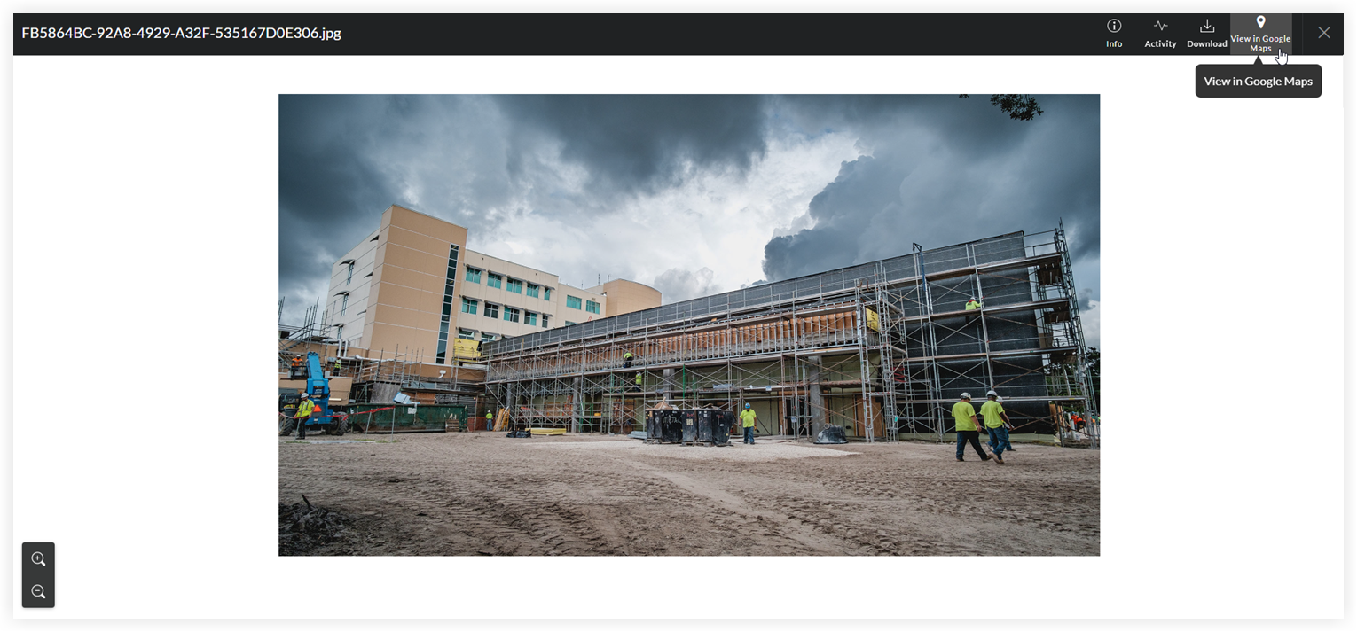
GPS 座標は、サードパーティのツールによってマッピングされます。Procore は、マッピング ツールの精度や信頼性について責任を負いません。
Note
If the digital image does NOT contain GPS coordinates, the 'View Google Maps' button is grayed out and unavailable.
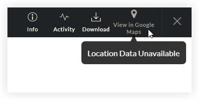
Most smartphone cameras have a built-in GPS function. When you take a photo, the camera automatically captures the GPS coordinates of the location where the image was taken. To learn how to adjust the GPS function on a camera, refer to the camera manufacturer's documentation.
サポートされているツール
上記で詳述した [Google マップで表示] ボタンは、次の Procore ツールで使用できます。
ツール名 | 関連するチュートリアル | ||
|---|---|---|---|
整合性問題 | |||
対応 | |||
カスタムツール | 適用外 | ||
日報 | |||
文書 (会社レベル) | |||
文書 (プロジェクトレベル) | |||
建機 (レガシー) (会社レベル) | 建機 (レガシー) (プロジェクトレベル) | ||
フォーム | |||
事件 | |||
指示 | |||
検査 (プロジェクトレベル) | |||
会議 | |||
観測 | |||
残工事リスト | |||
情報提供依頼 | |||
提出資料 | |||
用事 |