How do I compare a real-world LiDAR site scan against my 3D design model in the Model Manager?

Deployment Status & Regional Availability

Model Manager, Procore’s next-generation replacement for the Models tool, officially launches in General Availability across the UK and Ireland (UKI) on October 15, 2026, alongside a global Beta for all other regions. Procore Mobile App (iOS/Android) support is also live in Beta as Procore continues to transform 3D model workflows. Stay tuned for additional features in future releases.
For platform deployment status & regional availability Show/Hide

The Model Manager and the Models tool can be active on the same project at once. Administrators are not required to disable the Models tool.

Platform

Deployment Status/Region

Learn More

Web

  • General Availability: United Kingdom & Ireland (UKI) on October 13, 2026

  • Beta: All other regions

iOS

  • Beta: All regions

Android

  • Beta: All regions

Model Manager Beta: Access & Guidelines

  • Registration: Participating companies must sign the Procore Beta Agreement. Once signed, your Procore Administrator will coordinate with your Procore point of contact to enable Model Manager on specific projects. It is not available in Procore Explore.

  • Support & Feedback: Please report critical or breaking issues directly to Procore Customer Support. For general feedback, feature requests, and non-critical issues, contact your dedicated Beta program lead or Procore point of contact.

  • Beta Notice: This feature and its supporting documentation are in active development. Beta services are provided strictly "as is" for evaluation purposes, carry no standard warranties or liability, and are subject to change or discontinuation without notice. For full terms, please refer to the Procore Subscription Services Agreement.

Background

The Model Manager supports native point cloud files directly inside the Next-Gen Viewer to help teams monitor construction progress. With native Point Cloud support, users can view real-world as-built conditions captured with LiDAR alongside your theoretical 3D models. By combining these data sets, you can easily verify that ongoing on-site construction matches your project's official design requirements without requiring external software.

Answer

You can upload and view your site scans alongside your 3D design models by using the integrated point cloud support inside the Next-Gen Viewer.

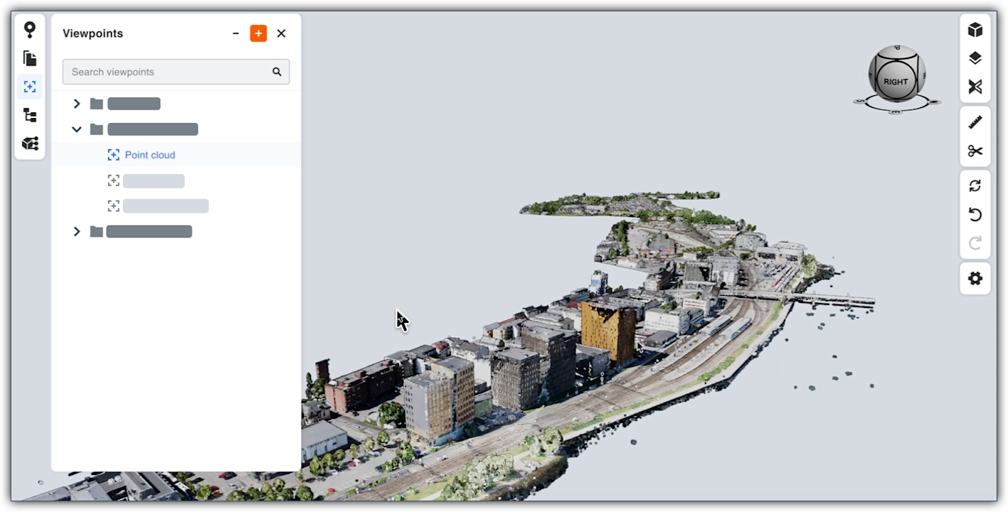
This image shows the Viewpoints panel in the Model Manager's viewer with point cloud data in view.

Supported File Formats

For details, see What file formats does the Model Manager support and do I need to manually process them?

View Options in the Next Gen Model Viewer

You can interact with point cloud data in these ways, depending on your coordination needs:

  • Single File View: Open an individual LAS or RCS viewpoing to inspect a standalone site scan in the Next-Gen Viewer.

  • Federated Project Model: Open the federated project model in the Next-Gen Viewer to merge your point cloud files directly with your existing 3D model's viewpoints. This allows you to compile hundreds of files into one federated scene to instantly cross-reference reality against the design layout.


Windows is a registered trademark of Microsoft Corporation in the United States and other countries. Google Chrome, Android, and Google Play are trademarks of Google LLC. iPhone, iPad, and App Store are trademarks or service marks of Apple Inc., registered in the U.S. and other countries and regions. iOS is a trademark or registered trademark of Cisco in the U.S. and other countries and is used under license by Apple Inc. Autodesk, AutoCAD, Civil 3D, Navisworks, and Revit are registered trademarks or trademarks of Autodesk, Inc., and/or its subsidiaries and/or affiliates in the USA and other countries. SpaceMouse is a registered trademark of 3Dconnexion. All other trademarks are the property of their respective owners.

See Also

Loading related articles...